
Capri is one of the most photographed islands in the world, yet much of what defines its true character remains invisible to those who experience it only from land or through rigid, high-traffic boat routes. From the sea, the island reveals a different narrative—one shaped by erosion, light, silence, and inaccessible stretches of coastline that standard itineraries inevitably bypass.
Sailing along Capri’s perimeter without predefined stops allows the island to unfold gradually. The cliffs are no longer postcard backdrops but living geological forms, marked by caves, fractures, and terraces suspended above the water. Many of these sections are unreachable on foot and overlooked by group tours focused on fixed highlights.
The Western Coast: Where the Island Becomes Raw
The western side of Capri, particularly between Punta Carena and the area beyond the Grotta Verde, is among the least explored by conventional routes. Here, the coastline is harsher, shaped by open sea currents and stronger winds. The limestone cliffs rise almost vertically, with sparse vegetation clinging to impossible angles.
Viewed from the water, this stretch conveys a sense of isolation rarely associated with Capri. There are no beach clubs, no docking points, no human interruptions—only the sound of the hull cutting through deep blue water and the shifting reflections on the rock face. At certain hours of the day, the light turns the stone warm and opaque, creating color gradients that cannot be seen from above.
Hidden Inlets and Sea-Level Perspectives
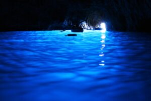
Standard itineraries tend to privilege famous caves and landmarks, often approached quickly and crowded with boats. Yet Capri’s coastline is punctuated by dozens of smaller inlets and recesses that do not carry names, signs, or schedules.
These natural indentations offer a more intimate reading of the island. From sea level, the scale of Capri changes: cliffs appear taller, caves deeper, and the contrast between light and shadow becomes more pronounced. Some viewpoints exist only for a few minutes a day, when the sun’s angle briefly illuminates a narrow opening or a submerged rock formation.
This is not about ticking locations off a list, but about observing how the island behaves in real time.
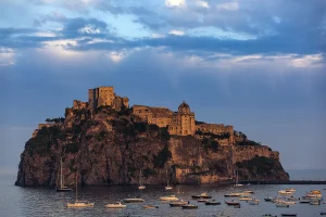
The Faraglioni Seen from Unexpected Angles
Even icons as famous as the Faraglioni take on a different meaning when approached without the constraints of timing and traffic. Beyond the classic frontal view, there are lateral perspectives where the rock formations appear fragmented, asymmetrical, almost abstract.
From these angles, the Faraglioni cease to be symbols and return to being geological phenomena—massive remnants of a collapsing coastline, shaped by millennia of erosion. The color of the sea around them shifts constantly, influenced by depth, light reflection, and underwater rock density.
Why These Views Are Usually Excluded
The majority of commercial routes are designed around efficiency and predictability. Fixed durations, shared schedules, and predefined stops leave little room for detours or slower navigation along less “marketable” sections of coast.
As a result, many of Capri’s most compelling sea-level views are simply passed by—or never approached at all. They require flexibility, local knowledge, and a willingness to prioritize observation over consumption.
Experiencing Capri Beyond the Obvious
Seeing Capri from the sea without standard constraints transforms the experience from a tour into a form of exploration. The island stops performing and starts revealing itself, piece by piece, through details that only emerge at water level.
These coastal stretches are not hidden because they are inaccessible, but because they do not fit into conventional narratives. For those willing to move beyond standard itineraries, Capri offers a quieter, deeper, and more authentic dimension—one that exists only offshore, between the rock and the open sea.