At the western end of the Sorrento Peninsula, where the land narrows toward Punta Campanella and the island of Capri rises across the water, there is a bay that looks remarkably different from the busy coastline nearby. Baia di Ieranto is surrounded by limestone cliffs, Mediterranean vegetation, old agricultural terraces, and the remains of a quarry that once transformed this quiet landscape.
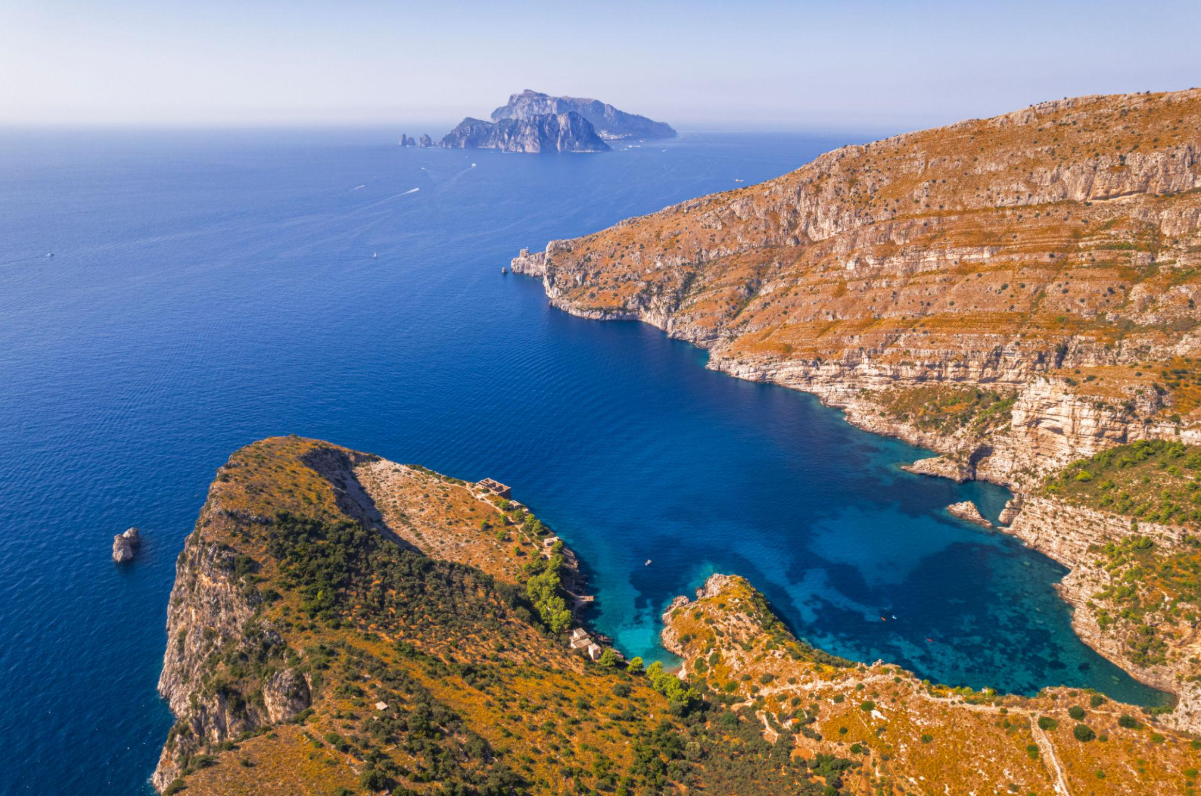
Its position is extraordinary. Across the water stand Capri and the Faraglioni, while the headlands around the bay mark the transition between the Gulf of Naples and the Gulf of Salerno. Yet the most distinctive feature of Ieranto is not simply its scenery. It is the protection that has allowed this part of the peninsula to retain much of its natural character.
Unlike many coastal destinations, Baia di Ieranto is not a place where private motorboats can freely arrive, anchor, and disembark passengers. Understanding the restrictions is part of understanding the bay itself.
Where is Baia di Ieranto?
Baia di Ieranto lies within the municipality of Massa Lubrense, near the village of Nerano, at the western end of the Sorrento Peninsula. It belongs to the landscape of Punta Campanella, the headland that separates the waters facing Capri from those extending toward the Amalfi Coast.
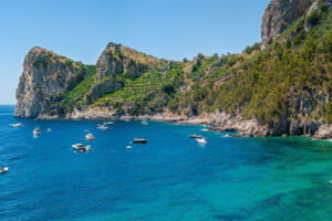
The bay is framed by steep limestone slopes, interrupted by small terraces, coastal vegetation, and paths that descend toward the water. Its relatively isolated position is one reason the surrounding landscape feels so different from the heavily visited towns farther along the coast.
For travelers familiar with Sorrento, Positano, or Capri, Ieranto provides another perspective on southern Italy’s coastline. Here, the dominant features are not hotels, beach clubs, or waterfront restaurants, but cliffs, vegetation, and the changing colors of the sea.
The relationship with Capri is particularly important. The island’s famous Faraglioni are visible across the water, creating a direct visual connection between two landscapes that visitors often experience separately.
The Faraglioni of Capri from another perspective
Most photographs of Capri’s Faraglioni are taken from the island itself or from boats navigating around its southern coastline. From Baia di Ieranto, the formations become part of a much wider panorama.
Looking across the water, the Faraglioni appear beyond the mouth of the bay, with the open sea between the mainland and the island. Their familiar silhouettes take on a different relationship with the landscape: instead of dominating the foreground, they form a distant landmark on the horizon.
This perspective helps explain the geography of the region. Capri is closely connected to the Sorrento Peninsula, both visually and geologically, and its limestone formations belong to a larger coastal landscape shaped by the sea over immense periods of time.
It is also a reminder that the coastline can be appreciated without approaching every landmark directly. Some of its most memorable views depend on distance, orientation, and the surrounding landscape.
The bay of the Sirens: mythology and coastal geography
Long before Ieranto became a protected natural landscape, the waters around Punta Campanella were associated with one of the Mediterranean’s best-known myths: the Sirens encountered by Odysseus during his return to Ithaca.
Ancient traditions placed the Sirens along this part of the Italian coastline, and later interpretations connected the story with different locations around the Sorrento Peninsula and the nearby islands.
Baia di Ieranto has become particularly associated with the legend. The FAI, the Italian heritage organization responsible for the land, describes the bay through this connection, recalling the ancient tradition that situated the Sirens here.
There is no archaeological evidence establishing Ieranto as the literal location of the episode. Its importance lies instead in the relationship between mythology and geography.
From the exposed headlands and narrow passages to the islands visible offshore, the landscape provides a compelling setting for stories about navigation, danger, and the irresistible attraction of the sea.
The myth is therefore best understood as part of the region’s cultural identity, rather than as a historical event that can be assigned to a precise location.
From limestone quarry to protected landscape
Baia di Ieranto has not always been a quiet natural refuge. During the twentieth century, limestone extraction became an important activity in the area, leaving visible traces on the slopes above the water.
The quarry was part of a period when the resources of the Sorrento Peninsula were exploited for industrial purposes. Stone was extracted from the coastal rock, and the operation required paths, working areas, and infrastructure that altered the original landscape.
Mining eventually ended in the 1950s. What remained was a coastline shaped both by natural processes and human activity.
A decisive change came in 1987, when the industrial company Italsider donated the property to the FAI, Fondo per l’Ambiente Italiano. The organization subsequently undertook conservation and restoration work to protect the landscape and make its historical and environmental significance accessible to visitors.
Today, the former quarry is one of the elements that makes Ieranto especially interesting. Rather than concealing every trace of its industrial past, the area preserves evidence of the relationship between local communities, natural resources, and the coast.
The agricultural terraces, rural buildings, and old extraction sites tell different chapters of the same story: a landscape that has been cultivated, exploited, abandoned, and eventually protected.
Why Baia di Ieranto is protected
The waters around Ieranto form part of the Punta Campanella Marine Protected Area, established to conserve the marine ecosystems of this exceptional stretch of coastline.
The protected area is divided into zones with different levels of restriction. These regulations govern activities such as navigation, anchoring, fishing, diving, and access by recreational vessels.
In the more strictly protected zones, ordinary boat access and anchoring are prohibited, with only specific authorized activities permitted. The restrictions help reduce disturbance to marine habitats and protect the ecological value of the coastline.
This distinction matters for anyone planning to explore the area by sea. Baia di Ieranto should not be treated as a conventional swimming stop or a freely accessible anchorage for private motorboats.
Access to the protected waters depends on the applicable regulations and any authorizations issued by the managing authority. Visitors should not assume that a private boat tour includes entry into the bay.
For current navigation rules, consult the official Punta Campanella Marine Protected Area.
How to visit Baia di Ieranto on foot
For visitors who want to experience Ieranto directly, the established approach is the walking trail from Nerano.
The route begins near the village square and follows a path through a landscape of olive trees, cultivated terraces, Mediterranean vegetation, and increasingly open views of the coastline.
As the trail continues, the panorama gradually changes. The surrounding hills give way to the sea, and the shape of the bay becomes visible from above. In clear conditions, Capri and its Faraglioni stand beyond the headlands.
According to the FAI, the walk from Nerano takes approximately 40 to 45 minutes in each direction, depending on pace and conditions. It is classified as a moderately difficult route, with uneven ground and a significant elevation change.
Appropriate walking shoes, drinking water, and sun protection are important, particularly during the warmer months. The trail is not suitable for everyone, especially visitors with limited mobility.
The FAI manages the land and provides visitor information and guided activities. Before planning a visit, check the organization’s official Baia di Ieranto visitor information for access conditions, opening arrangements, and temporary restrictions.
Can you swim in Baia di Ieranto?
Swimming conditions and permissions require particular attention.
Although Ieranto is known for its clear water, it is part of a protected marine environment where specific restrictions apply. In addition, the FAI has published a notice referring visitors to a maritime authority ordinance concerning areas temporarily closed to swimming.
This means that photographs showing swimmers in the bay should not be taken as evidence that swimming is permitted everywhere or at all times.
Before entering the water, visitors should consult the latest notices from the FAI, the Punta Campanella Marine Protected Area, and the relevant maritime authorities.
Respecting these rules is an essential part of preserving the environment that makes Ieranto worth visiting.
What a boat journey around Punta Campanella reveals
A private boat experience along the Sorrento Peninsula offers a different way to appreciate the geography surrounding Ieranto, without implying access to its restricted waters.
The coastline near Punta Campanella is characterized by steep limestone headlands, small inlets, and the changing relationship between the mainland and Capri. From the sea, the peninsula’s shape becomes more apparent, and the visual connection between Nerano, Punta Campanella, and the island is easier to understand.
For travelers exploring this part of the coast, the experience is not necessarily about reaching every small bay. It can be about understanding the wider landscape from a perspective that roads and walking paths cannot provide.
Luca Tour Boat’s Nerano and Capri private boat itinerary connects two important destinations in this maritime landscape. It offers an opportunity to discover the coastline around Nerano and the southern side of Capri, with the route and permitted activities planned according to sea conditions and applicable regulations.
The protected status of Ieranto remains a separate consideration. The itinerary should not be interpreted as including entry, anchoring, swimming, or disembarkation inside the bay.
Why Ieranto matters beyond its scenery
The importance of Baia di Ieranto extends beyond its views of Capri or the clarity of its water.
It represents a different approach to experiencing the Italian coastline: one in which protection, historical memory, and the natural environment take precedence over unrestricted access.
In a region where coastal destinations are often defined by the number of visitors they attract, Ieranto demonstrates the value of maintaining limits. Its walking paths preserve the relationship between land and sea, while the marine regulations recognize that not every stretch of water can support the same activities.
The result is a place that rewards observation and understanding as much as direct exploration.
For travelers interested in the broader geography of southern Italy, Ieranto adds an important dimension to a journey through the Amalfi Coast and surrounding coastline. It is a reminder that some of the Mediterranean’s most significant landscapes are defined not by what visitors can do there, but by what has been preserved.
Frequently asked questions
Where is Baia di Ieranto located?
Baia di Ieranto is near Nerano, in the municipality of Massa Lubrense, at the western end of the Sorrento Peninsula. It faces the island of Capri and belongs to the protected landscape around Punta Campanella.
Can you reach Baia di Ieranto by private boat?
Private motorboats cannot freely enter or moor in Baia di Ieranto. The waters are subject to marine protection rules, and access by boat requires compliance with the restrictions and authorizations established by the managing authority. The established visitor route is the walking trail from Nerano.
How long is the hike to Baia di Ieranto?
The walk from Nerano generally takes around 40 to 45 minutes each way. The trail is moderately difficult, with uneven surfaces and a substantial elevation change. Visitors should wear suitable footwear and carry drinking water.
Can you swim in Baia di Ieranto?
Swimming is subject to the applicable marine protection rules and any temporary restrictions. The FAI currently directs visitors to a maritime authority notice concerning areas closed to swimming. Always check official information before entering the water.
Can you see the Faraglioni of Capri from Baia di Ieranto?
Yes. The bay faces Capri, and the Faraglioni can be seen across the water in clear conditions. This is one of the area’s distinctive views, showing the island’s famous rock formations from the Sorrento Peninsula rather than from Capri itself.